Deep learning
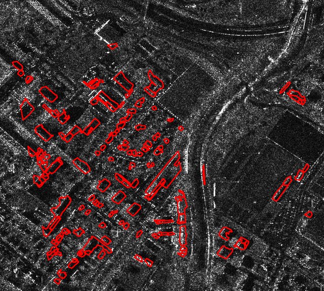
Building detection in rural areas
Centroid-based patch extraction and UNet models on 25 cm orthophotos, balancing accuracy and training efficiency.
These projects show how we turn spatial data into practical outputs for mapping, monitoring, deformation analysis, and environmental intelligence.
Centroid-based patch extraction and UNet models on 25 cm orthophotos, balancing accuracy and training efficiency.
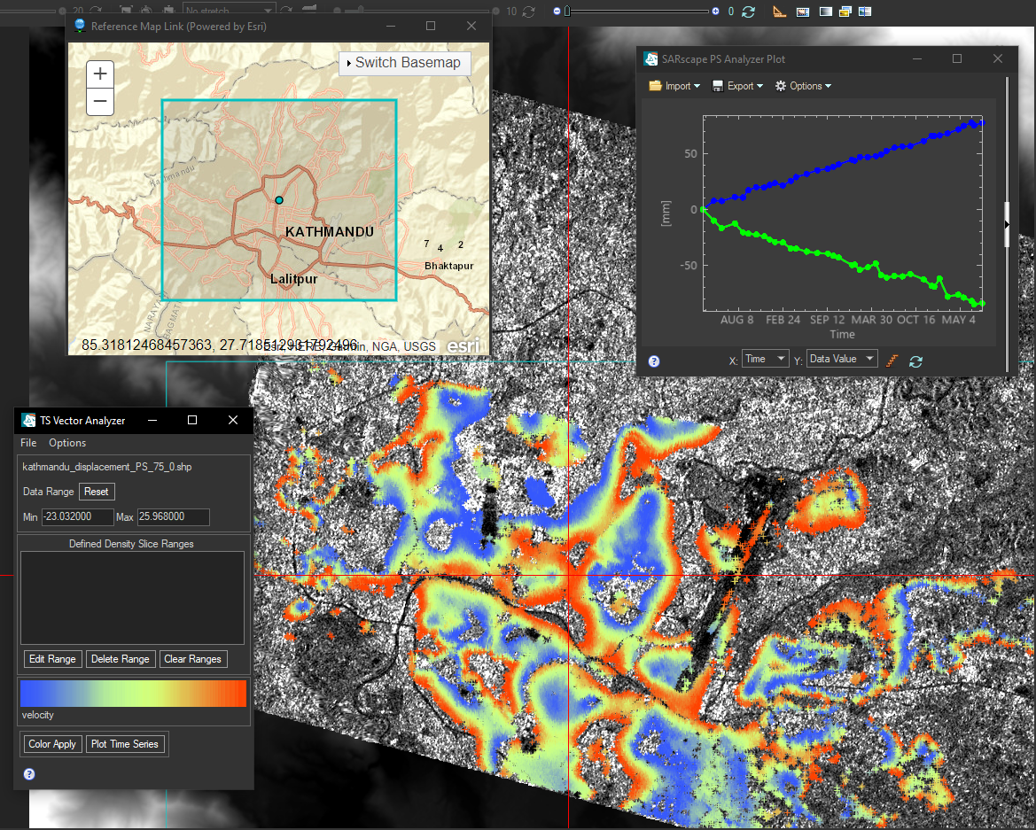
Persistent Scatterer InSAR analysis for land subsidence and uplift monitoring between 2022 and 2025.
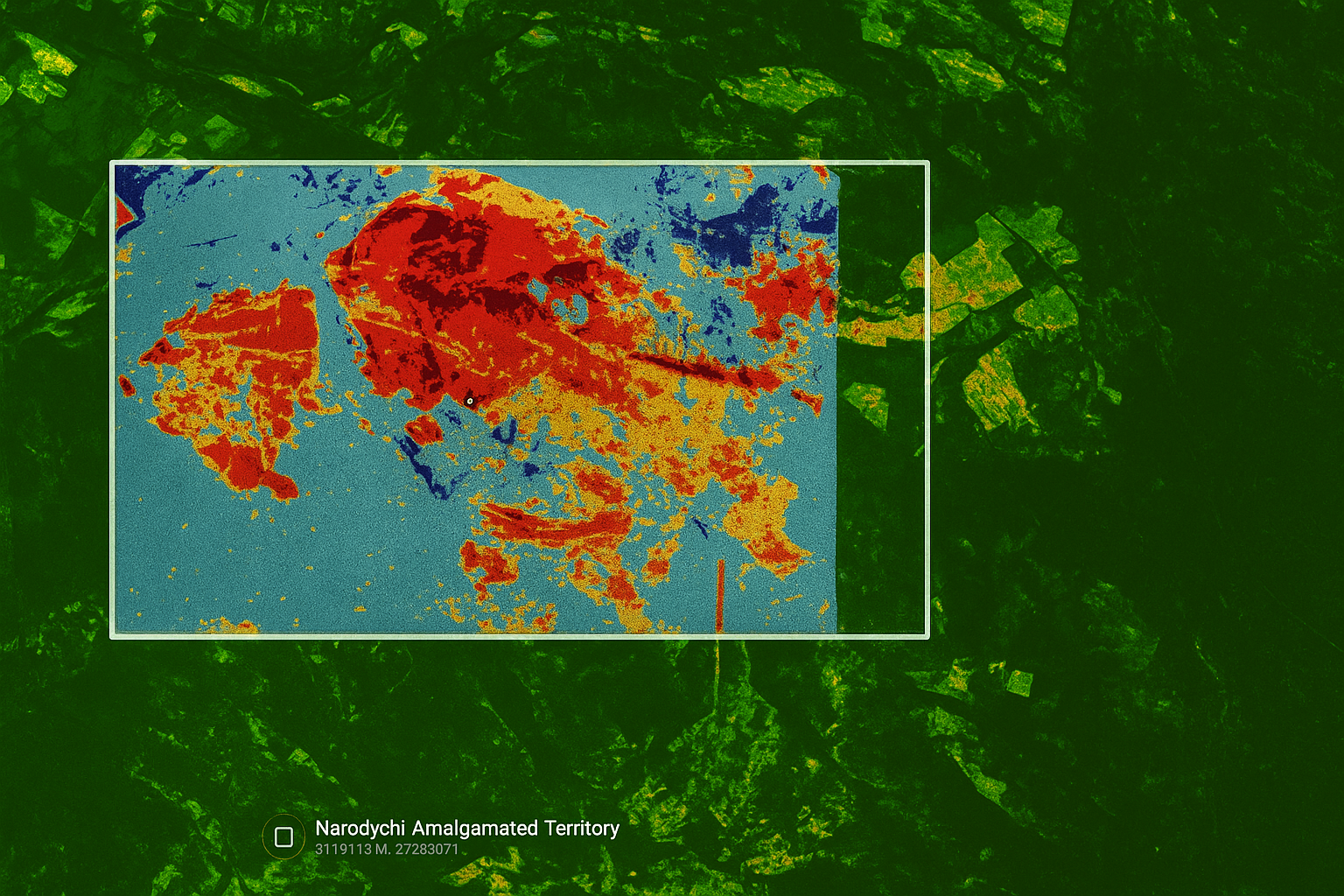
Automated task-based burn area detection using pre- and post-event imagery.
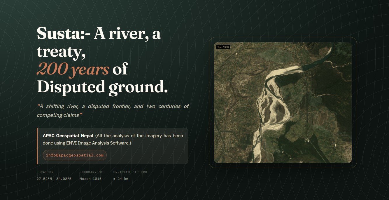
Analysis of border issues between Nepal and India using geospatial techniques.
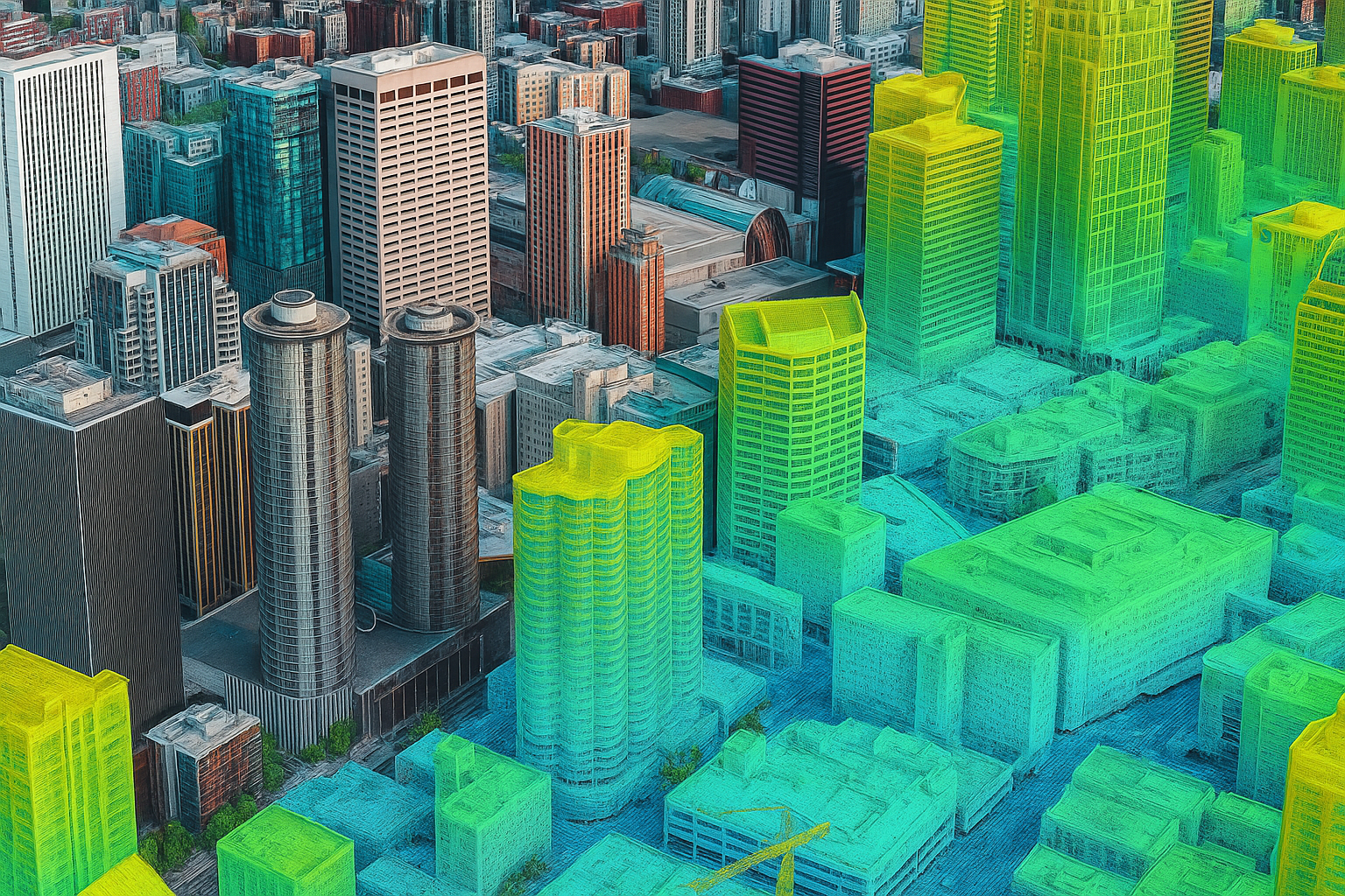
High-resolution 3D mapping of urban areas for infrastructure planning and development.
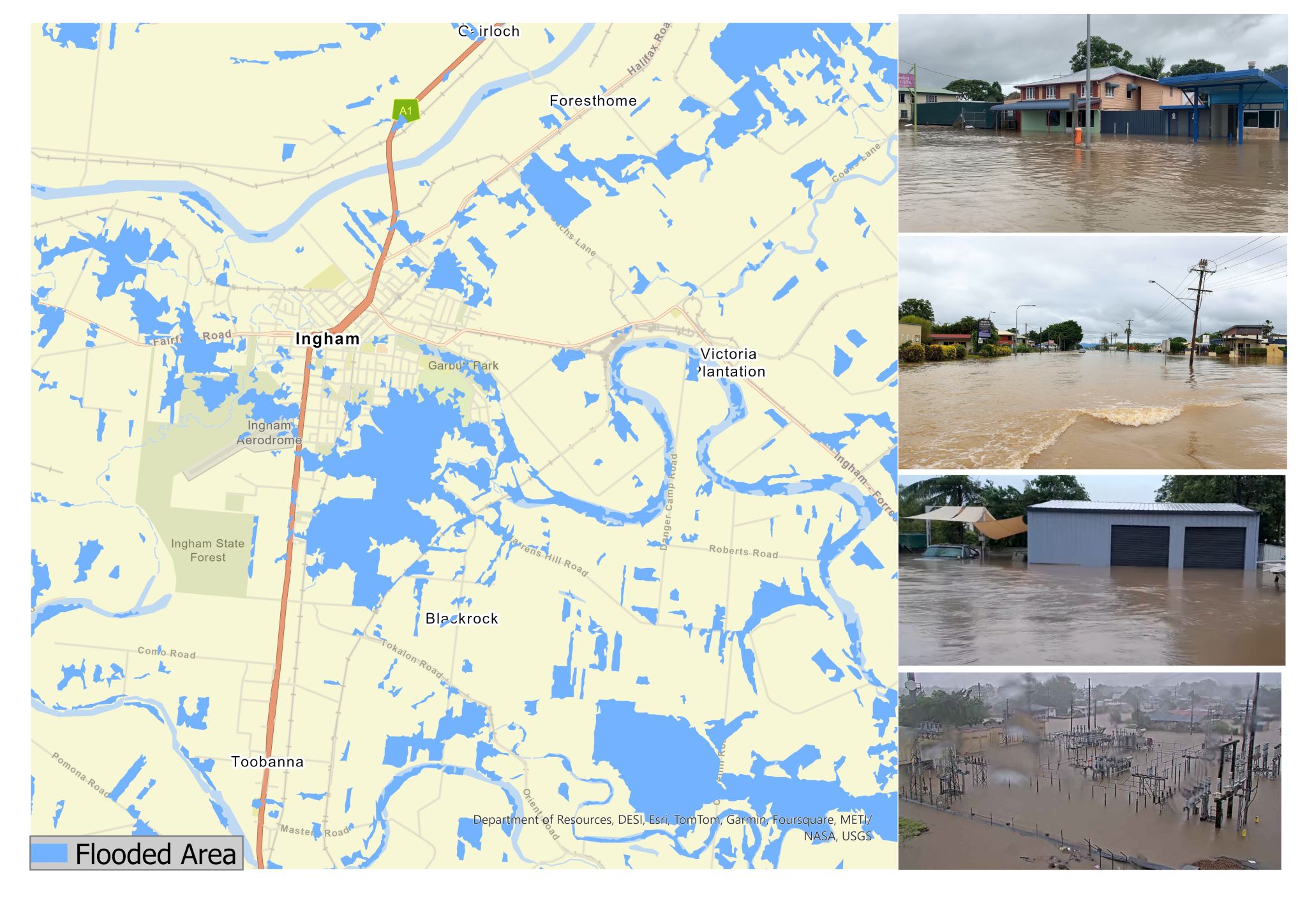
Real-time flood monitoring and analysis using Synthetic Aperture Radar technology.
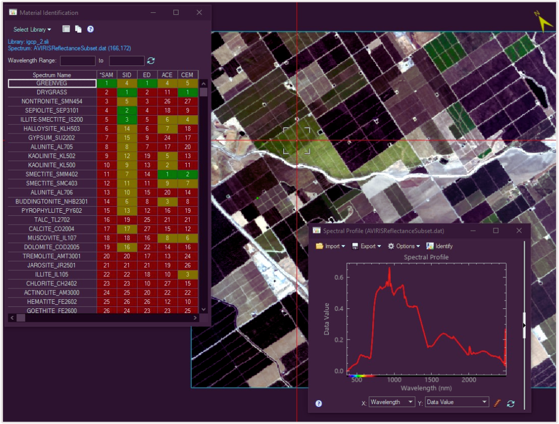
Assessing vegetation health and biodiversity using hyperspectral imaging techniques.